Ross-Tech 2010 Tour of the Southeast
Page 3
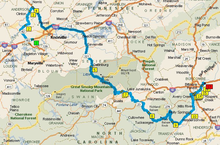
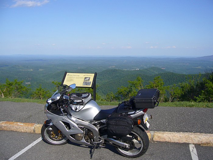
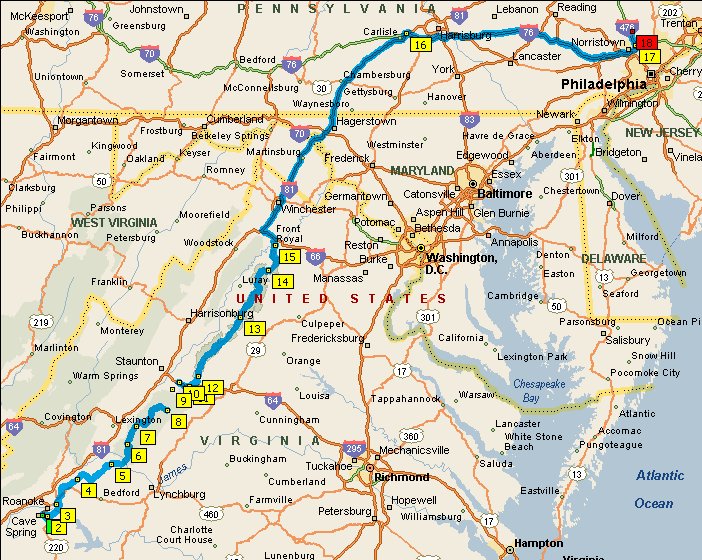
Day 15: Monday 3. May -- Knoxville Loop, ~167 miles
When we woke up this day, it was still raining, so we had breakfast and decided
we were in no rush to do anything. We had to stay near Knoxville
that day because we were planning to pick up a spare fuel pump for Eric's bike
the next morning. We had originally contemplated going back down to
Tellico Plains, then up and over the
Cherohala Skyway,
and ride the Dragon at Deal's
Gap. Unfortunately, US 129 is closed at the northwestern end of the Tail of
the Dragon, so doing this would have meant retracing our steps and would thus
have been 240 miles or more. The weather did start to clear
after breakfast; the front which had inundated western Tennessee had passed to
the east, but was still over the area we wanted to ride, so we put off deciding
what to do until after lunch. Once we'd had lunch with our local friend,
the the rain had moved even further to the east and we headed out on the shorter
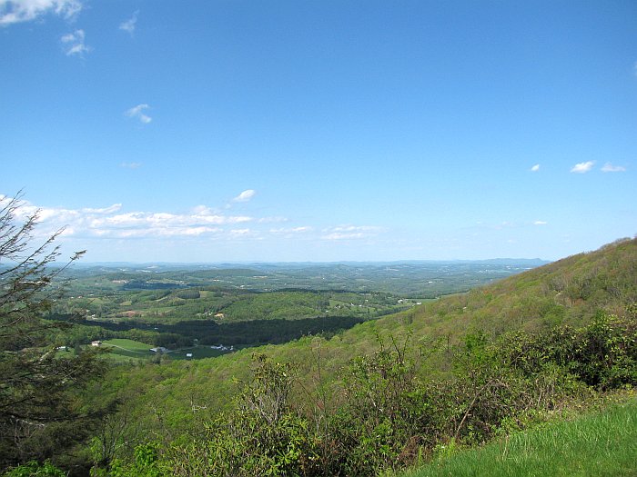
local loop shown above. US 129 south of US 411 down to the
Foothills Parkway is actually a nice ride and there was zero traffic on it,
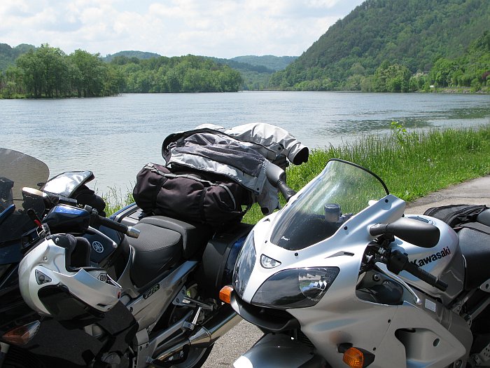
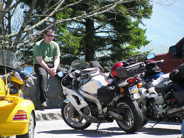
presumably due to the road closure. Here we are taking a short break
at Tellico Lake:
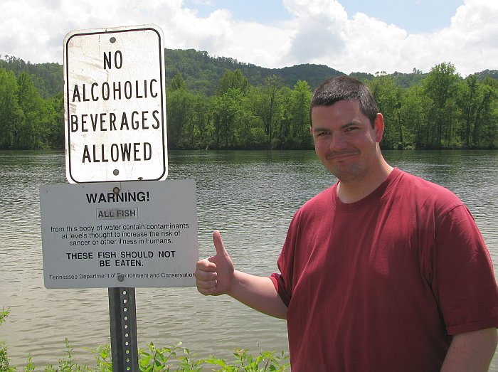
It's pretty, but this sign kind of makes you wonder..
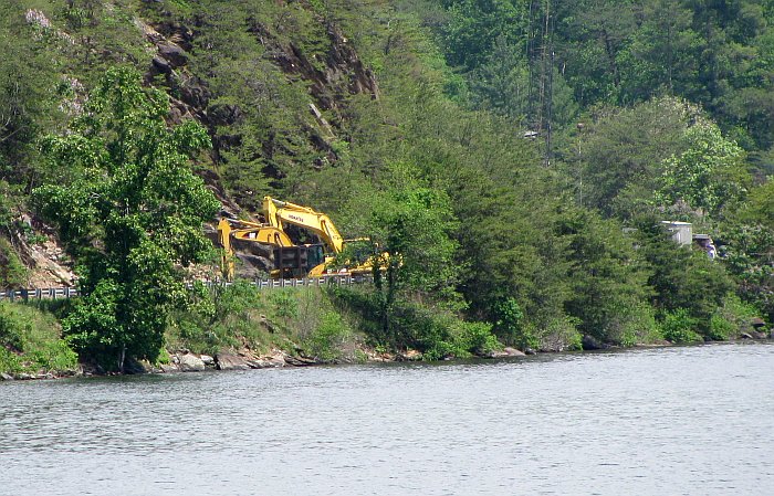
From here, you could also see the some of the equipment being used to clear the
rockslide which had US 129 closed a but further down, but we could not see the
rockslide itself:
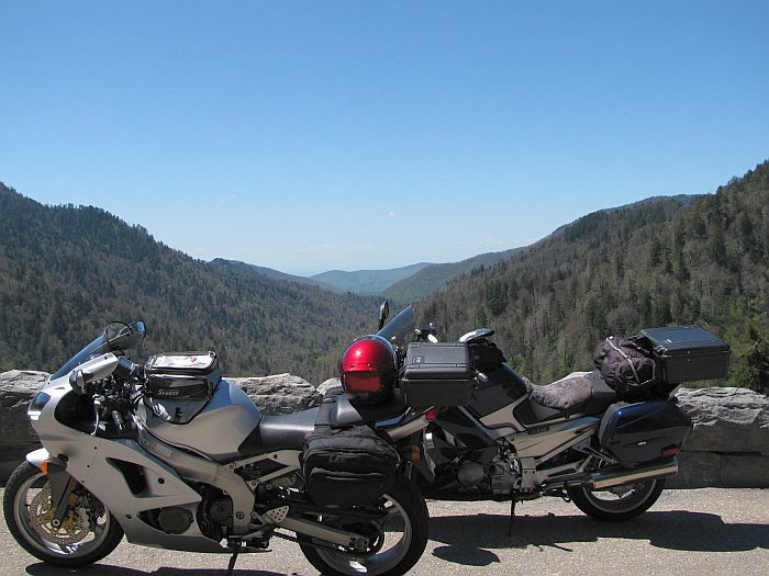
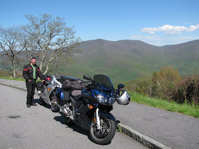
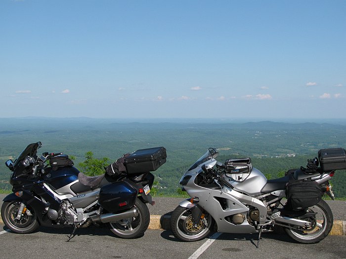
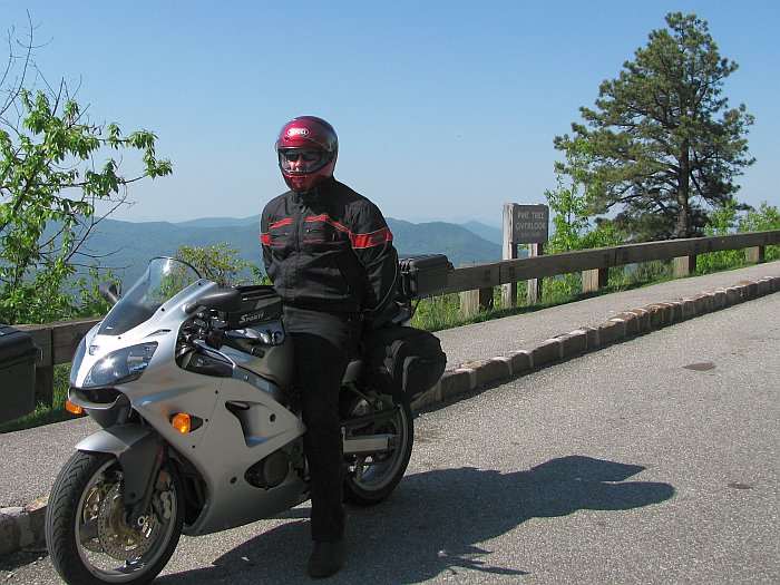
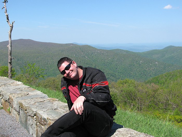
At this point, we hit the Foothills Parkway. There's me and my bike in the
exact spot we had taken a picture of Eric and his bike 3 years earlier.
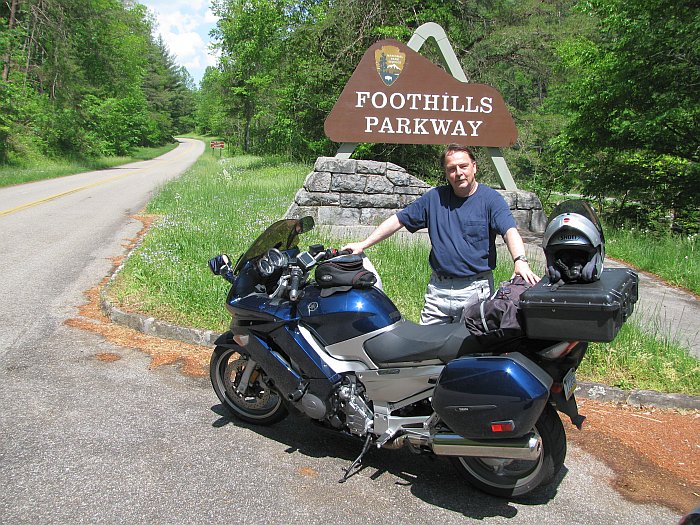
The Foothills Parkway is pretty, but it was a bit of a let-down 3 years ago.
Almost anything is right after you've ridden the entire Blue Ridge Parkway.
But in this case, we had not done that yet, so I think we enjoyed it more this
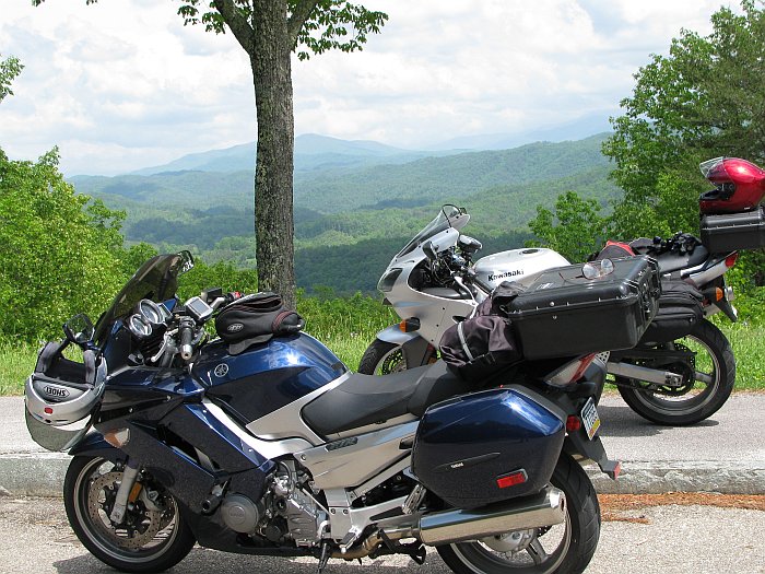
time than last. Here's our bikes with the Smokies in the background.
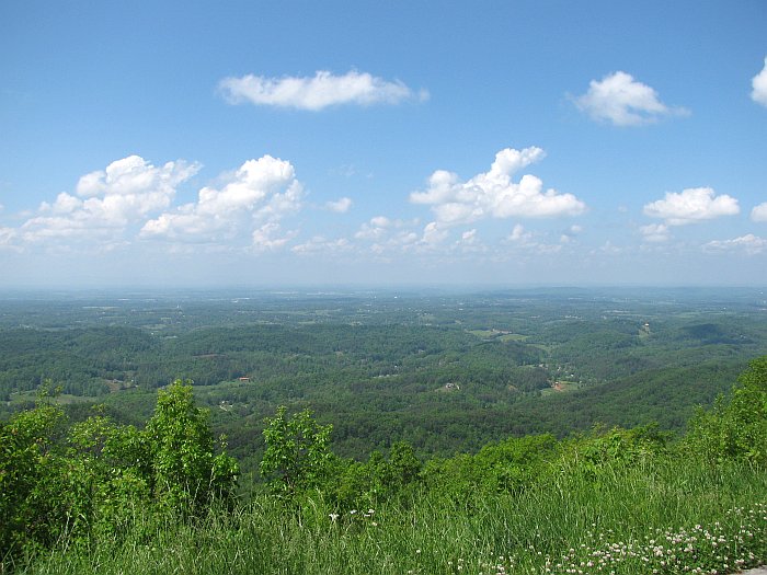
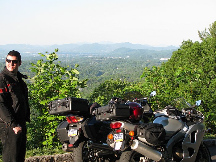
And here's a shot looking west from another place where we stopped:
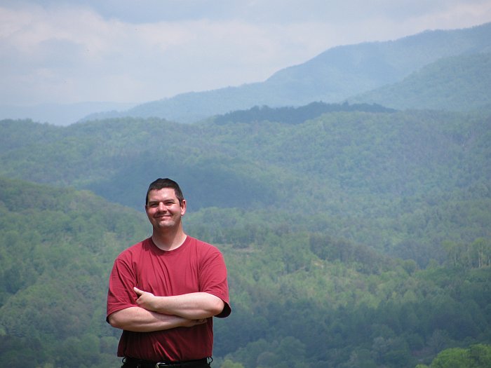
Lastly there's this picture of Eric with the Smokies in the background which I
thought turned out rather nice:
After the Foothills Parkway, we had planned to take Little River Road towards
Gatlinburg; we had missed that road the last time. But on a whim, I turned
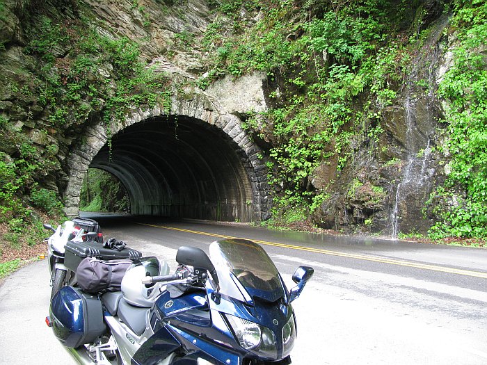
up the road to Cades Cove.
The road up to Cades Cove was nice enough; here we are stopped just past the
tunnel where we were trying to decide if we really wanted to go up there.
However, the 11-mile loop road within Cades Cove was torture. It has
a speed limit of 20 mph, which we figured wouldn't be too bad, and indeed it
would have been quite OK at that speed. The problem is the bloody
people in their cars are all doing 5 mph or less, and it's a one-lane, one-way
loop road, so you can't pass them. We got stuck behind several
very slow moving cars and truck, not one of which was willing to use the
numerous pull-outs to let us by. This makes me give the
following recommendation: Do not do the 11-mile loop on a motorcycle
unless you're willing to idle along in first gear the whole way.
This wasn't too horrible on my FJR which has a more upright seating position and
plenty of cooling fan capacity for the radiator. However, it was torture
on Eric's ZZR, both because the riding position simply isn't suited for that,
and because the cooling fan is marginal. We didn't realize it at the
time, but his ZZR sizzled out about a pint of coolant.
After coming back down from Cades Cove, we did do the Little River Road east to
441, and then took the Gatlinburg Bypass, which is just one lane in each
direction and twisty enough in its own right. From there we headed north
on US 321 through the Pigeon Forge area. We were dreading this because the
last time we were there, the traffic was absolutely horrible, but it wasn't too
bad this time. We then turned back towards Knoxville on US 441 which
is somewhat scenic, but not great. We ended the day back at the
Sleep Inn and went out to dinner with our friends again.
Day 16: Tuesday 4. May -- Knoxville TN to
Asheville NC, ~221 miles
We started this day heading entirely in the wrong direction because that's where
the Kawasaki dealer was, from whom our friend ordered a fuel pump for Eric
(waypoint number 4 on the above map). We departed our hotel shortly
after 9 and arrived at the dealer around 10. We went to their
parts department and asked what time their UPS delivery comes. "Between 10
and 2". OK, we'll wait. Eric pushed his bike over
into the shade created by a very large motor home with a "For Sale" sign on it
at far edge of the dealer's lot and proceeded to fiddle with his chain. I
hung around relatively bored; I looked at at the stuff at the dealership, but
they had nothing I was interested in buying except maybe a C14, which I sat on.
It didn't feel much different than my FJR. The dealership did take pity on
my and provided me with free coffee. Right around noon, just as Eric
finished playing with his chain (he did a really thorough cleaning without any
means of getting the back wheel off the ground), the UPS truck showed up, and we
got the pump. We figured now that we had a spare, the repaired one
would last for the rest of the trip (and we were right about this), so Eric
stuffed it into one of his bags and we had a quick lunch at the Shoney's next
door. Then we hit the freeway for a bit to try to make up for lost
time. We got off on US 321 and had to make our way through Pigeon
Forge again, which again wasn't too bad. Back up the Gatlinburg
Bypass and up and over US 441 across the Great Smoky Mountains National Park.
Although we had ridden this area 3 years prior, we had skirted around the park
then so had never seen this section. It was very pretty.
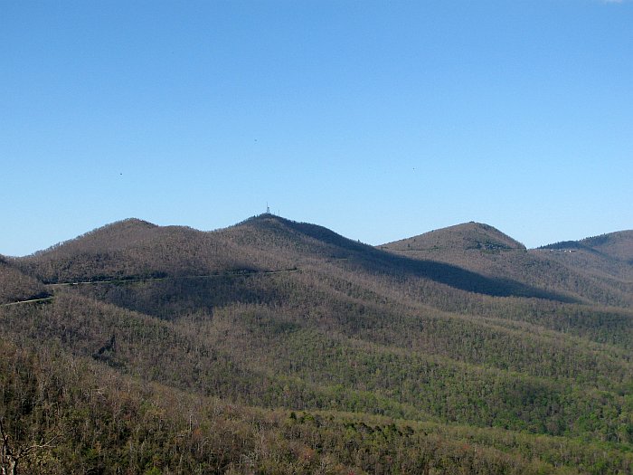
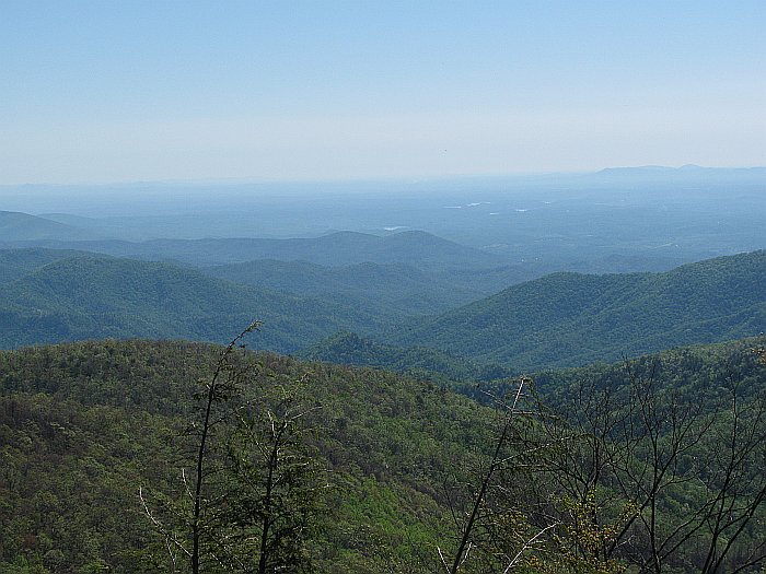
Here we are stopped most of the way to the summit of the pass:
We stopped there for a bit because for the first time, my FJR ran poorly due to
an altitude change. 2006 and 2007 FJRs are known for this; my
understanding is the check the ambient air pressure using the MAP sensor when
the ECU is powered on and assume the ambient pressure doesn't change from then
on. Well, I had started it down low right after lunch and we
were now roughly 4000 feet higher. The fix is simply to shot down the
engine and re-start it, so that the ECU learns the current ambient air pressure.
This worked fine. Here's a more detailed view down the valley we had just
come up:
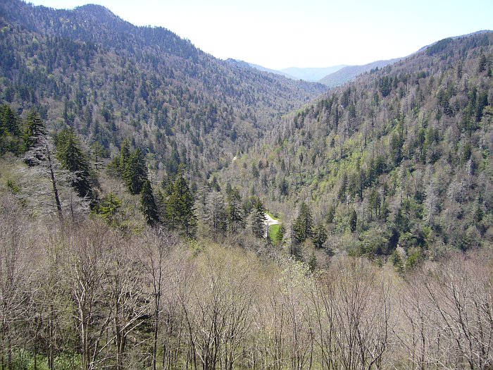
As you can see, we were high enough up that the deciduous trees here had not yet
leafed out. Not much further along, we reached the summit, which is
also the state line:
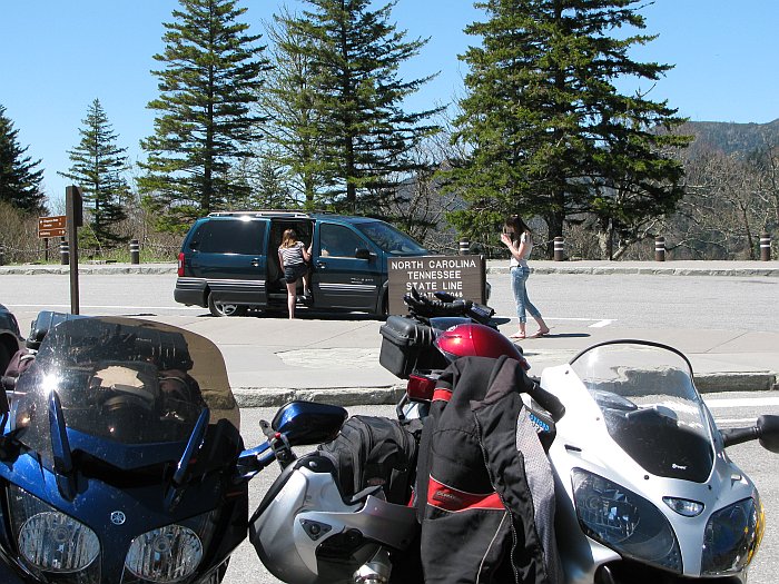
Here's Eric, looking a bit disgruntled, waiting for me to be done taking
pictures, I suppose. ;-)
And a view to the east in the direction that we were going:
Where US 441 Exits the park, you can immediately turn onto the Blue Ridge
Parkway, which is what we did:
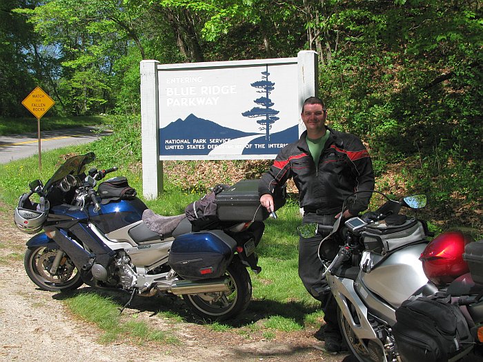
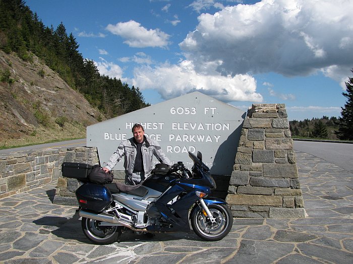
This is the very bottom of the BRP; from here it's 469 miles of twisty, curvy
road to Shenandoah National park, in theory without a single traffic light or
stop sign the whole way. We rode the whole thing southbound in 2007
and I was really looking forward to doing it northbound now, and due to the
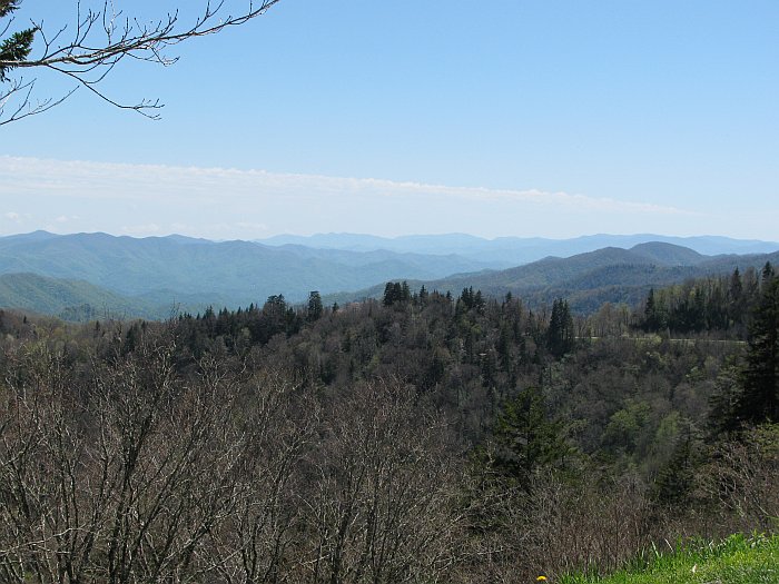
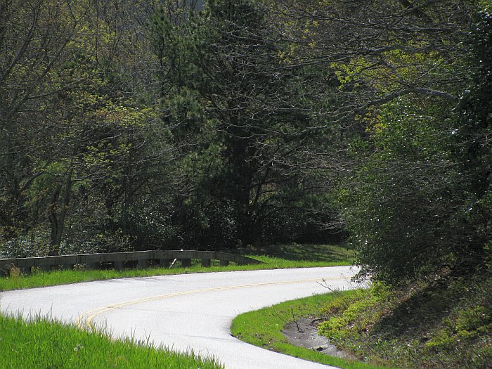
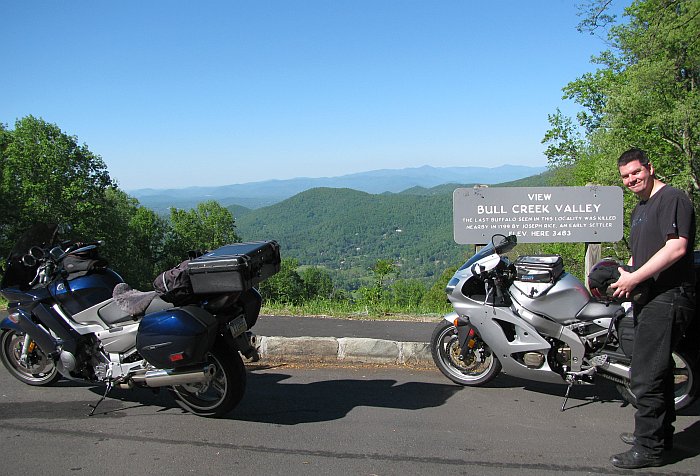
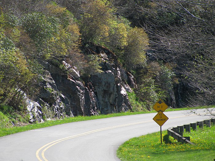
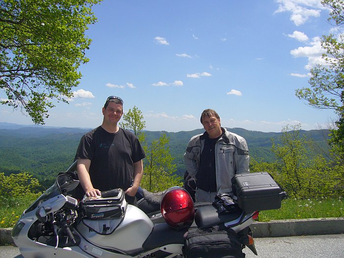
absolutely perfect weather, I was not disappointed. Here we have
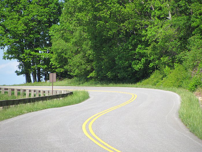
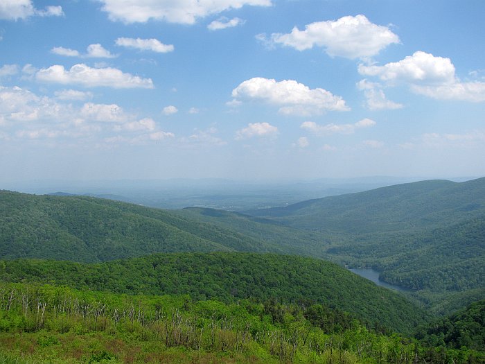
more pictures of our first day on the BRP; words are not really necesssary:
Unfortunately, the section from Wagon Road Gap to Elk Pasture Gap was closed due
to a rockslide, so we had to take a detour, first southeast on US 276, which
would have been fun except for the condition of the pavement, then northeast on
NC 280 and finally north on NC 191 until it re-joined the BRP. We
then followed it through to the east side of the Asheville area where we ended
the day at a Days Inn and had dinner at yet another Mexican restaurant.
Day 17: Wednesday 5. May -- Asheville NC to Roanoke
VA, ~ 288 miles
We had started this day expecting to spend all of it on the BRP and hopefully
doing roughly 358 miles to Buena Visa VA, but it didn't quite work out that way.
About a 20 mile section of it was closed for storm damage clean-up. The
detour was not marked, and our Garmins decided to have fun with us, leading us
down a nasty chip-sealed tertiary NC road, which turned into a dirt road, which
became a dead end. Once we found our way back to something resembling
civilization, we ran into some nice construction delays (NC 194 was being
re-paved) and then needed a comfort break, where I noticed Eric's bike was
venting steaming coolant right after he shut it down. Checking
the expansion tank revealed it was empty. Not a big problem since
the gas station where we had stopped had distilled water, and he was able to
fill it up again, and it was running file. But that ZZR does not
like stop-and-go traffic, particularly uphill. Of course, we did
take a few pictures, the first again at high altitude not far northeast of
Asheville:
Then stuck in detour traffic:
And back on the BRP at lower altitude:
Approaching Roanoke with the sun low in the sky:
At this point we knew we'd run out of daylight long before we made it to Buena
Vista, so we took US 220 a few miles towards Roanoke and ended the day at a
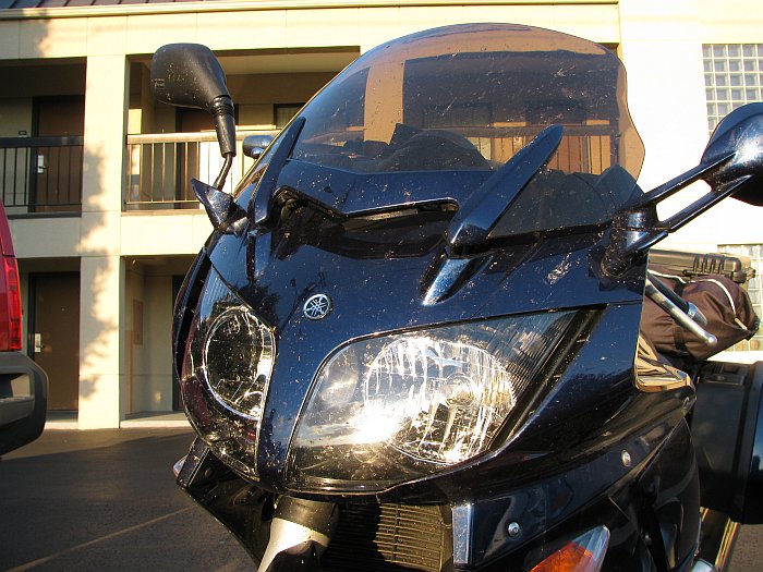
Quality Inn. Interestingly, there were far more bugs on that section
of the BRP than there were in Florida, where my bike had remained relatively
clean. This is what it looked like at our hotel in Roanoke, ick..;-)
Day 18: Thursday 6. May -- Roanoke VA to Lansdale PA,
~496 miles
I think this is the only day where we went considerably further than we had
planned. Of course we finished the BRP, had lunch in Waynesboro, and
then continued onto the Skyline Drive through Shenandoah National Park to Front
Royal, VA, which was one possible destination for the day. But it was only
5:00pm at that point, so there was plenty of daylight left. I
thought this might happen, so I had planned an alternate destination of
Frederick MD, with the next day consisting of a leisurely ride through rural
northern Maryland and southeastern PA back home. But at Front Royal,
we decided those roads would be nothing more than a let-down after the last 3
days of bliss, so we popped a few miles west on I66 to I81 to Carlisle PA, where
we at dinner at the Petro, and then took the PA turnpike home to Lansdale.
It got dark as we were eating dinner, and we usually don't ride after dark,
because we're normally on secondary roads and don't want to risk colliding with
deer and such, but we figured the PA turnpike would be relatively safe in this
respect. So here are the last few pictures..
Eric, astride his bike on the BRP:
Another shot of the BRP itself. Did I mention that I love this road? ;-)
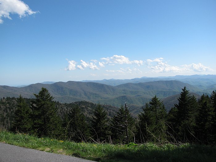
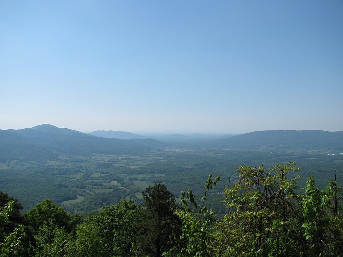
Yet another beautiful overlook or two:
And lastly, a shot from the Skyline Drive:
The Skyline drive was actually a bit tedious due to the speed limit of 35 mph,
which is supposedly strictly enforced. It also has more traffic on it than
the BRP (and the BRP had essentially none). So between getting stuck
behind cars which observed this limit and not wanting to run at go-to-jail
speeds when we weren't stuck behind slower vehicles, we weren't having all that
much fun. We finally gave up for the last 25 miles and pretended we
were still on the BRP (where the speed limit is 45 mph) and started enjoying
ourselves again.
The drone home on I81 and I76 wasn't exactly fun, but it wasn't as bad as I had
imagined either. Temperatures were pleasant, actually requiring a
wind-proof insulating layer under our mesh jackets after the sun set, and of
course we saved ourselves another night of hotel bills by doing this. The
stupid thing is, I hardly got any sleep that night, despite being home in my own
bed; I suppose all the coffee I drank with dinner didn't help with that, but it
certainly did help keep me alert on the turnpike.
Data
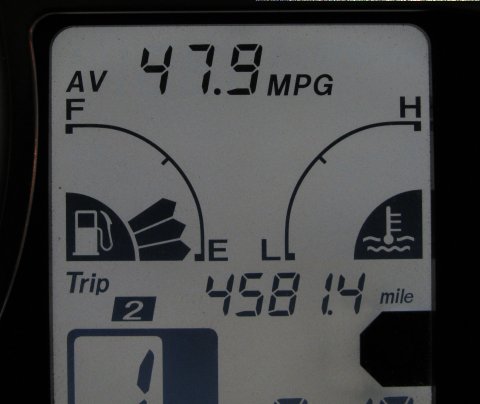
My odometer claims we covered a total of 4581 miles. This may
not match the total of the day-by-day mileages stated above which were
calculated by Streets & Trips. I used my Trip 1 counter for miles
since the last fill up, not daily mileage.
My instrument panel claims my bike averaged 47.9 mpg. I think that's not
bad for 1300cc,145hp shaft-drive beast, but I did not keep track of fuel
actually put in the tank vs. miles ridden at gas stops.
Eric did that sporadically and averaged over 50 mpg, with at least one tank
around 60. That his ZZR got better mileage than my FJR hardly
comes as a surprise, it's 600cc, chain drive, and much lighter.
Reflections (written on Sunday 9. May)
I'm not sure about Eric 'cause I haven't really discussed it with him, but I
had a great time. I really needed to get away from my daily
grind, including my e-mails and such for a while, and thanks to my wife Linda
who dealt with them as best she could while I was gone, I did accomplish that.
Would I want to repeat much of this trip? To be honest, no.
However, I'm glad I did it. From the Chesapeake Bay Bridge down, all
the way back up to Tellico Plains TN, it was all stuff I'd never seen before,
and it was excellent to see it. But now that I have seen it and ridden it,
I've got a Been There, Done That attitude towards most of those places and
roads. The only real exception is the Forgotten Coast of the
Florida Panhandle. If I were looking for an "Ocean Front" property
in the eastern half of the US, it would probably be there.
Now from northern Georgia through the Appalachians, that's some wonderful
country. I'd be perfectly happy to turn around and do the BRP again
in both directions right now, and I'm not sure I'd ever get tired of that. :-)
As far as the BRP itself, some people diss it. I do not understand this at
all. Where else can you find a road that's 750 km long, with endless
twists and turns; with the longest straight section measured in the hundreds of
meters at most; with pavement that ranges from good to great; with scenery that
ranges from stunning and spectacular to merely pastoral and woodsy; all without
a single traffic light, stop sign, strip mall, or other commercial
establishment, and with practically no traffic on it? I think it's
totally unique, because I can't think of a single other road on this earth
which meets all those criteria. IMO, it is certainly the best ride
in the US east of the Mississippi. Three years ago, I said I'd
ride that road again, and I'll repeat that statement now. In fact, I
can hardly wait!
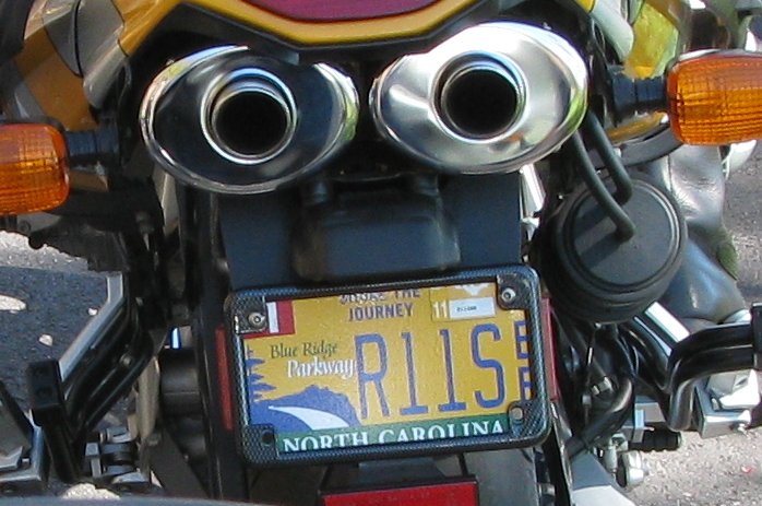
Oh, yes, approaching a lane closure due to some storm damage, we met a guy on a
BMW with what may be be the best bike license plate ever:
The End
Up to Uwe's Bike Trips Page