Ross-Tech 2010 Tour of the Southeast
Page 2
Day 8: Monday 26. April -- Key West to Florida City, ~130 miles
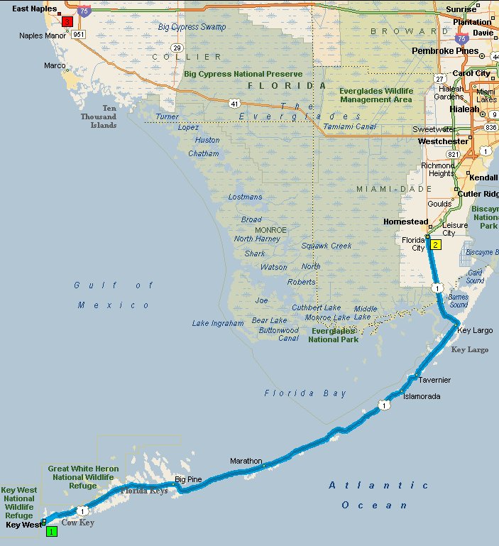
The original plan for this day was to take US 1 back to Florida City, then to
head up Rte 997 and west across the
Tamiami Trail (US 41)
across the Everglades and end the day somewhere in the vicinity of Naples, which
would have been about 250 miles, but this was not to be. We departed Key
West knowing there was a strong cold front over the Everglades; radar pictures
showed it as a solid line of violent thunderstorms, and it was slowly creeping
south. We made it back to Key Largo, perhaps 25 miles from Florida
city before we got any rain. At that point, we debated finding a
place to stay in Key Largo, but hotel prices in the Keys are not exactly
attractive, so put on our rain gear and pressed on, which may not have been the
wisest thing to do. It was just rain and quite tolerable until we
got back to the southern tip of the mainland, where we met the meat of the
cold-front. Temperatures dropped 10 or 15 degrees F in less than a mile,
and there was a strong wind right out of the west, in other words directly from
our left, gusting to at least 40 mph, maybe more. On a wet road in with
lots of traffic, in a downpour, this felt downright unsafe. Unfortunately,
there was no place to stop and wait it out, not even a paved shoulder, so all we
could do was continue north, hoping for the best. One of the first
places to stop as we approached Florida City was the Comfort Inn we had stayed
in on the way down to the Keys and we pulled in under the canopy outside of
their lobby. Since stormy weather wasn't how we wanted to see the
Everglades, and we knew this place wasn't bad and was reasonably priced, we
checked in and called it a day. A few hours later, I had some
regrets, as the brunt of the storms had passed, but it was still cloudy, and the
report for the next few days was quite good, so we spent the afternoon doing
laundry again, and then took a nice walk to dinner at the
Farmers Market Restaurant. We were literally the only customers
when we first walked in, so the service was great; the food wasn't bad either.
Day 9: Tuesday 27. April -- Florida City to Bradenton, ~260 miles
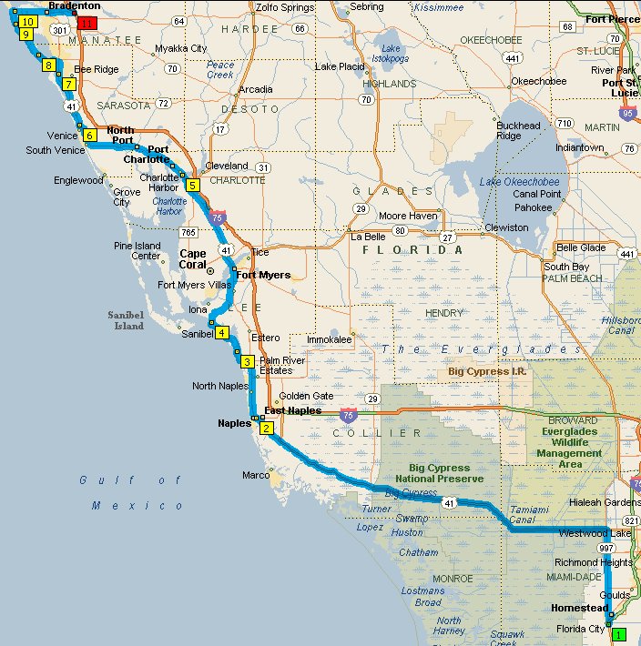
Once you get north of Florida City on Rte 997, it gets somewhat agricultural.
Interestingly enough, much of the "agriculture" consists of countless ornamental
plant nurseries, many specializing in palms. I guess all those palms in
south Florida have to come from somewhere. We then turned west
across the Everglades on US 41. The easternmost portion isn't all that
interesting. You have a canal on the north side, and some green on the
south side. It gets better once you get into the Big Cypresss
National Preserve. There we stopped at the Big Cypress Gallery.
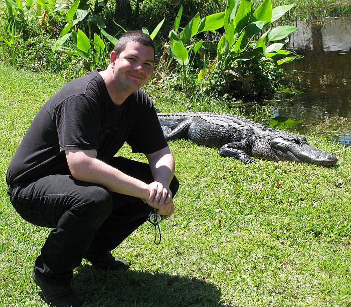
We didn't actually go inside, what caught our attention was an alligator sunning
himself on their lawn. At first, Eric didn't think he was real, he
was just sitting there motionless (as alligators are apt to do) and Eric thought
he might be a fake to get the tourists like us to stop. We
parked on the other side of the lot from the gator and Eric went to pose with
him. Personally, I would not have gotten that close and taken my
eyes off him!
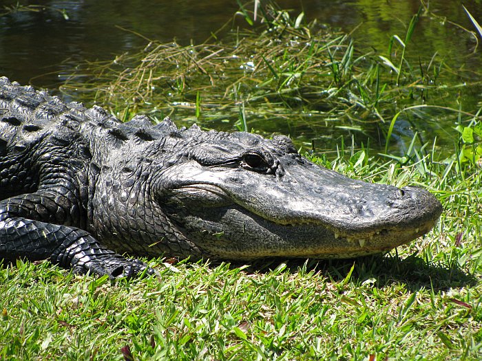
Here's a closeup of him (don't worry, it was done at full 10x zoom):
After this series of pictures, Eric decided he wanted one of the gator and his
bike, but the gator decided he didn't know what to make of the bike and scurried
off into the water as it approached.
Here's a picture of the swampy parts:
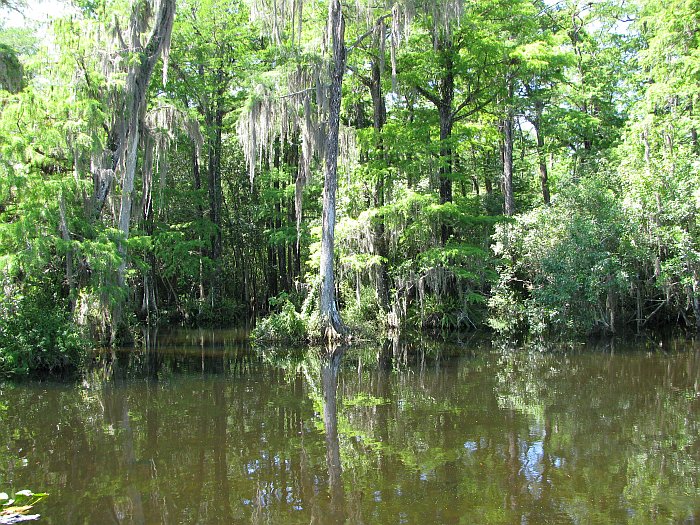
which the gators love:
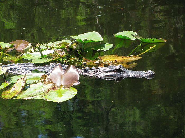
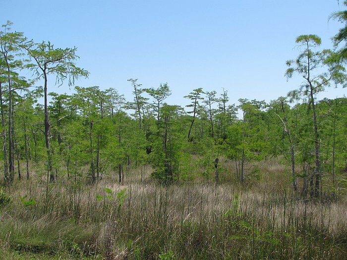
And the grassy parts, which are actually more representative of the Everglades
as a whole:
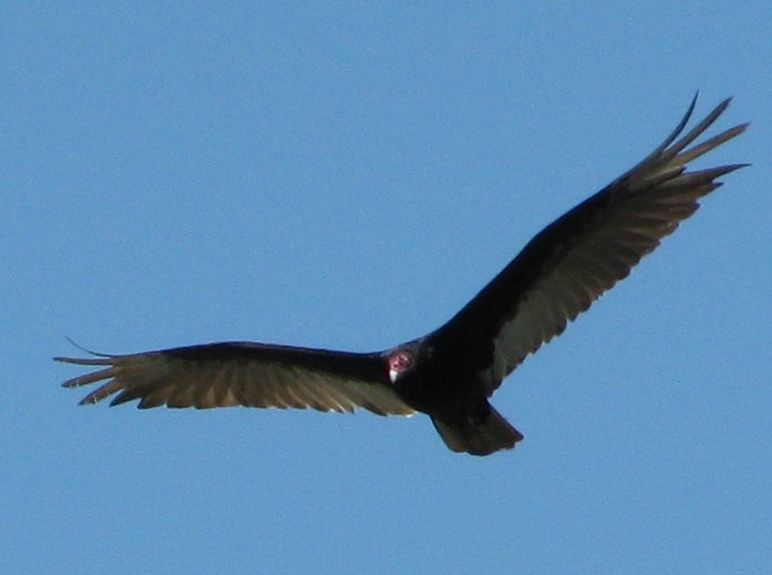
At this stop, there was a nice bird-of-prey flying around. I'm not sure
exactly what kind of bird this was, but he did look impressive:
[Edit: I've been informed this is a
Turkey Vulture, a
carrion eater, not a bird-of prey]
After the Everglades, we continued up US 41 in in a northerly direction to
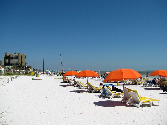
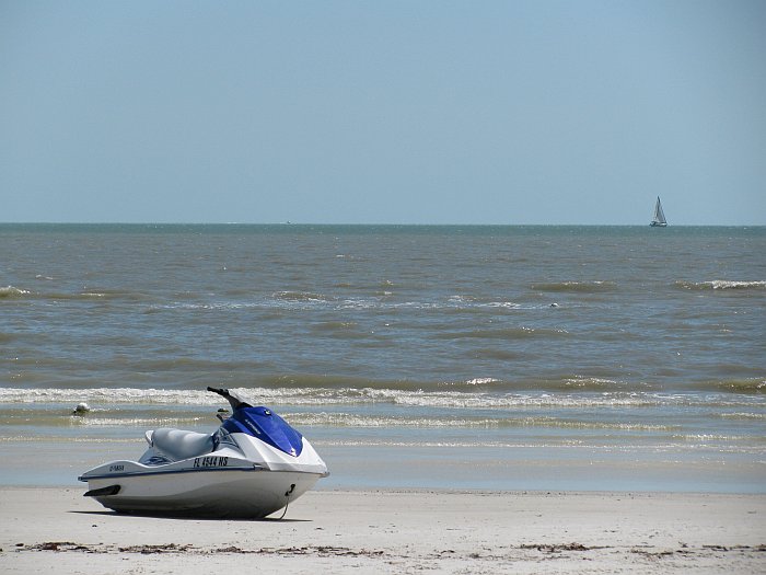
Bonita Springs where we hit Rte 865 on the barrier islands of Bonita Shores and
Ft. Myers Beach:
After that we We did not see much of the actual coast until we crossed the
bridge onto Longboat Key near Sarasota. Somewhere around Port Charlotte,
we took a comfort break at a gas station and Eric looked rather exhausted:
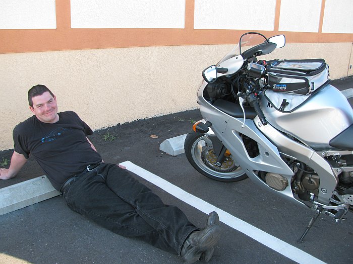
His bike was not designed for low speed riding on the "urban" roads, and his
all-black gear was less than optimal at low speeds in the mid-80s temperatures.
I suggested that he might buy some pants in a color other than black, but he
never did.
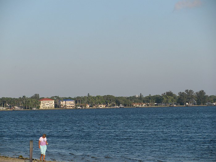
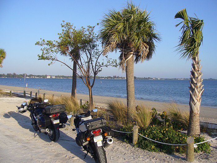
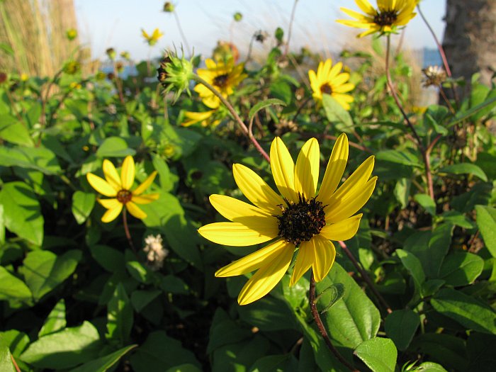
Longboat Key was fairly nice, but it seems we didn't stop for any pictures until
we turned back towards the mainland in the nice light of a late afternoon sun:
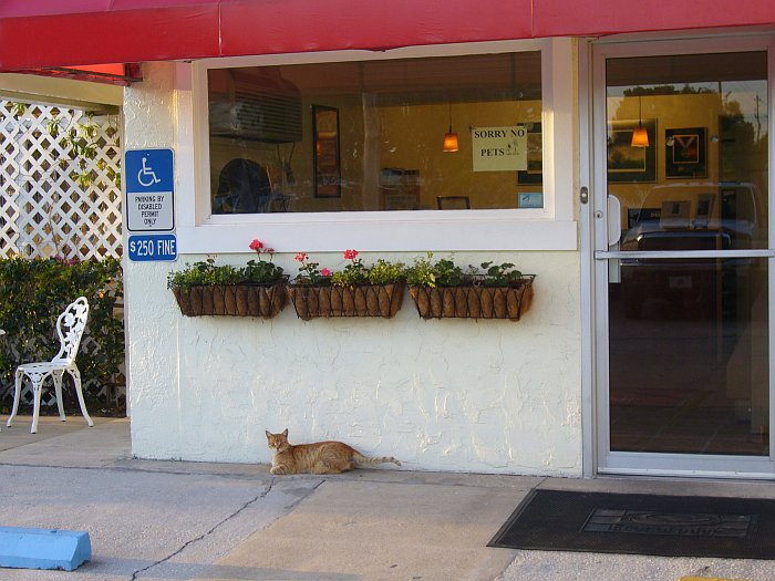
We continued a bit inland towards a cluster of inexpensive hotels to the east of
Bradenton near I75. There we found an EconoLodge with "do as I say,
not as I do" attitude:
However, we ended up staying at the Comfort Inn close by.
Day 10: Wednesday 28. April -- Bradenton to Tallahassee, ~316 miles
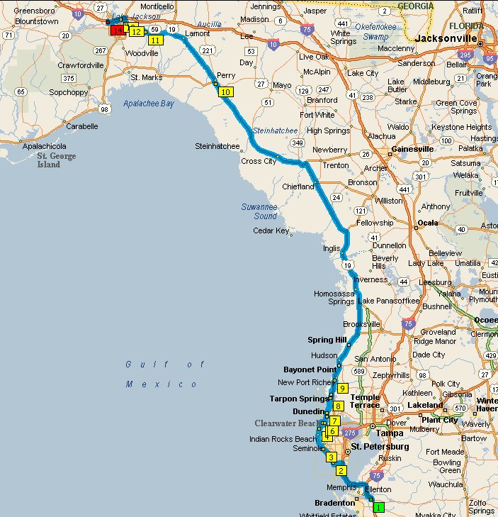
We started this morning with a short run up I75 and I275 to get to the Sunshine
Skyway Bridge across the Tampa Bay. This bridge is pretty impressive.
There was a rest area just before it and I was tempted to pull in, but decided
against it because from the entrance, it didn't seem it would have a view of the
bridge. It actually has a superb view of the bridge, but it was impossible
to get there by the time we realized this. After crossing the
bridge, we immediately turned west to the barrier islands on Rte 682, and
continued north on Rte 699 all the way up to Clearwater Beach. Once
again, Eric wasn't happy about the slow pace the road and traffic dictated.
I told him he needed to trade his track-rack in for a cruiser. ;-)
Somewhat inexplicably, it seems we don't have any pictures from that segment.
Once back on the mainland, we went north on Alt US 19 until it joined the main
US 19, which gets away from the coast relatively quickly. From about
Tarpon Springs all the way to Perry, US 19 is totally unmemorable.
The southern portion of that run has a totally excessive number of Pawn Shops
and Title Loan places, as well as billboards advertising various legal services
and bail bonds. This is obviously not the ritzy part of Florida.
At Perry, I would have preferred to turn west onto US 98, but there's a distinct
shortage of places to stay along there, and we were getting close to the end of
the day, so we continued northwest on US 19 to Capps, where turns straight
north, and we went west towards Tallahassee (where there are plenty of
reasonably priced accommodations) on US 27 for about 30 miles.
This section is fairly picturesque and and has some elevation changes,
unlike the rest of the state where the highest points are various bridges. We ended up staying in
a Sleep Inn on the northwest side of Tallahassee.
Day 11: Thursday 29. April -- Tallahassee to Destin, ~197 miles
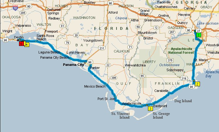
We started this day with a route that had many more waypoints on it to
keep us as close to the shore as possible. Streets and Trips told me
our route would be ~330 miles, which would have made for a somewhat long day,
and we were planning to meet up with someone in Destin that evening, so stopping
short wasn't really an option. What I didn't realize was that
I had a couple of waypoints completely out of order and even the originally
planned route would not have been much more than 200 miles. So we
set off down US 319 to where it briefly joins US 98 and continued down US to the
coast. We followed US 98 to where it re-joins US 319, which is where
the day got "interesting".
At
this stop sign, I waited for Eric to pull up beside me before proceeding.
Only he didn't. Now I knew he was close behind me very recently, so
turned my head and saw him stopped back on the shoulder, just before the fork in
the road. My initial reaction was that he was thinking we should proceed
up US 319, which actually would have taken us back towards Tallahassee, and was
obviously wrong. So I waited a while longer, and then did a
U-turn to go see what was up with him. First I pulled up beside him to ask
him what was up. Engine quit, with a lean sputter, as though it had
hit reserve or was out of gas, despite the fact that we had both filled up only
~50 miles earlier right next to the hotel we stayed in overnight. His bike
had done this once before, in 2006, in the middle of Nowhere, South Dakota,
under similar circumstances (recent fill-up). I couldn't stay in
the lane of traffic next to him, so I pull forward onto the shoulder and park my
bike in front of his, right about
here.
The shoulder there has a fair amount of pitch, so my bike was almost completely
vertical on its side-stand, but it appeared stable and I got off.
Whereupon my bike promptly plopped over into the grass onto its right side. :-O
Now let me tell you, an FJR is bloody heavy when it's laying on its side.
It took considerable grunting from both of us to get it upright again.
I promptly moved it over into the white-striped safety zone you see in that
picture. Damage: A broken off right-side mirror and some minor
scuffs on the fairing and hard case which will likely buff out. The
"Frame Sliders" which I put on the bike when I got it probably saved the fairing
from more damage.
OK, time to figure out why Eric's bike doesn't run. He decided that
the white-striped safety zone is a better place to ponder this than the shoulder
he's on, so he pushes his (lightweight) bike over there as well.
He figured one possibility is a tank venting issue. Open the
tank lid. Try starting. Nope. But it sort of ran for a bit
when he put it on full "choke". It's a carbureted engine, not fuel
injected. What seemed to fix it in South Dakota was some wait time
and a vigorous shaking, so we try that; but no joy. I then recalled
that he had made a comment in South Dakota that he hadn't heard the fuel pump
run when his bike wouldn't start. A fuel pump on a carbureted
engine? Yup; the tank outlet is lower than the carbs' fuel inlet, so it
needs a pump, at least when the tank isn't completely full.
Eric, there's some combination of stuff that always forces the fuel pump to run
for short time, right? He does that dance with the clutch and
ignition, but it does not make the fuel pump produce any sound. So
we break out the tools. Yes, thankfully we had a pretty complete set
of tools and were able to take off his fuel tank and gain access to the pump.
Disconnecting the electrical plug from it revealed 12V coming from the bike, but
an open circuit on the fuel pump side, so we'd definitely identified the
problem, but that wasn't exactly a huge help where we were.
They don't call that part of Florida "The Forgotten Coast" for nothing. ;-)
Looking at the fuel lines, it seemed eminently feasible to bypass the pump and
let fuel from an almost full tank gravity feed to the carbs.
We tried that, but the bike absolutely would not start. So we pull
the tank again and look at the fuel pump more carefully:
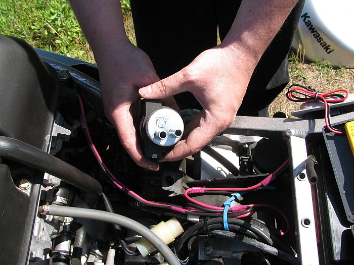
The other end of it that you can't see here has a plastic cover with a varnished
screw, indicating you're not supposed to take it apart. I
asked "What have we go to lose by taking it apart?" Eric replied
"Nothing, I guess." So we did. Inside, we find a set of contacts
that look a whole lot like an old-school set of ignition breaker points.
These apparently open and close based on fuel pressure, and look quite burnt.
So what do you do when you have burnt ignition breaker points? You file
them down some. The only file we had was part of a Leatherman
multi-tool, and it was a bit thicker and coarser than we would have liked, but
we made it work, and then checked the resistance at the pump's connector again:
2.4 ohms, YES! Put it all back together, and it started right
up!
By this time, we had spent over an hour working on it. During that time
a at least a couple of dozen cars went by, as well as a similar number of
Harley-Davidsons. Not one of them stopped to see if we could
use a hand. Three people did stop. The first was in a small
Winnebago motorhome. He asked if we needed any tools. We told
him, nope, we're good on tools and he left. The second was a guy on
a BMW RT. He actually hung out with us until we got Eric's
bike running again. I'm not sure why, but I didn't object to
the moral support. The third was a guy in a pickup from the
Florida State University Costal and
Marine Lab which was perhaps a 1/4 mile back down the way we had come.
I had seen his truck go by in one direction soon after we our predicament
started, and he stopped to try to help when he noticed we were still there a
while later when he came back. He told us he had many tools back at
the lab and if we needed anything, to come over and let him know.
So we know who the good guys are, and the loud-pipe Harley crowd ain't.
With Eric's bike running again, we decide to press on in the direction of Panama
City where we figured there would be some motorcycle dealerships.
FWIW, the
section of US 98 right where we were stuck is was one of the nicest parts of
coastal Florida; it's got pine trees right up to the beach in many places
and is totally non-commercial.
In Panama City, we stopped at Ron's Kawasaki, hoping they might have a fuel pump
in stock. They were extremely friendly and helpful, but didn't have the fuel
pump. Since it was already mid-afternoon and past the deadline for getting
it shipped from the warehouse that day, the soonest they could get it would be
Saturday, and that only with expensive overnight, Saturday-delivery shipping.
We didn't really want to spend the next two days in Panama City, and
Eric's bike had run fine for almost 90 miles with the "repaired" fuel pump, so
we decided to continue on to Destin, where there was supposed to be another
Kawasaki dealer. What Ron's did have was a very generic
mirror which bolted onto to the FJR reasonably well and actually gave me a
better view to the rear than the stock mirror. Yes, it's ugly, but it worked and
eliminated any question of legality regarding the missing mirror.
Ron's also answered the question why the area was positively swarming with
loud-pipe HD-pirate types; it was the first day of the
Thunder Beach Spring Rally.
Needless to say, our somewhat sporty bikes with quiet, stock exhaust systems
didn't fit in at all.
So despite these delays, we arrived in Destin several hours earlier than I had
expected, due of course to my mis-calculation of the day's mileage.
When we got there, we stayed at the Comfort Inn. This is probably the
cheapest hotel in Destin, but is actually quite nice, and is right across the
street from Henderson Beach State Park. We had dinner
that evening with Karl Denninger who writes the
Market Ticker and runs the
related forum, at the excellent
Sushi Siam restaurant in the Destin Commons.
Because we were rather preoccupied with the fuel pump thing and due to Karl's
schedule that evening, we did not take any other pictures that day, except the
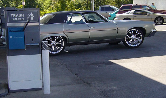
following one at a gas stop. This kind of thing is relatively common
in Florida; you take an older American car and put the biggest, ugliest, chrome
rims on it that you possibly can. It doesn't matter what the rest of the
car looks like, but you gotta have the rims:
Day 12: Friday 30. April -- Destin FL to Lincoln AL, ~ 305 miles
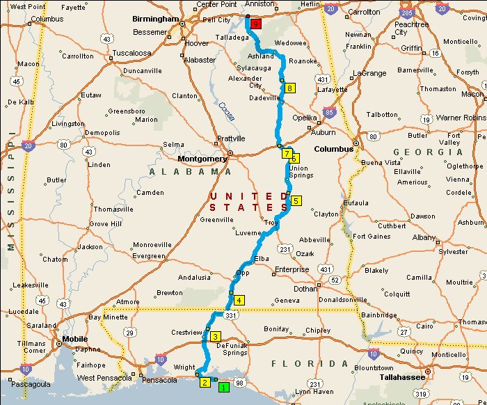
We had originally planned to go straight north from Destin towards Huntsville,
where we were planning to meet up with another friend, but the Kawasaki dealer
that we were told was was in Destin was actually a bit further west in Fort
Walton Beach, so we decided to head that way first, in the vain hope that he
might have a fuel pump for Eric's bike. Of course, he did not.
It being relatively early on Friday morning, we considered staying in the area
an extra day if he could get it shipped overnight for Saturday morning delivery.
He thought that was possible, but wanted an additional $143 for
shipping to make that happen. I know what it costs to ship something
overnight for Saturday delivery; it's less than half that, and Eric wasn't
willing to spend that, so off to the north we went.
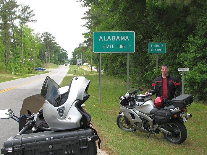
The Florida Panhandle is kind of pretty once you get above I10. Here
we are entering Alabama:
As we continued north in Alabama, we actually got some curves and elevation
changes. These were rather welcome after spending a week on Florida's
straight, flat roads.
This section of US 29 is pretty nice riding and was completely devoid of
traffic.
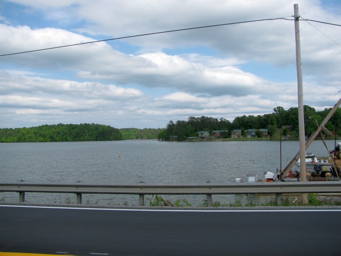
We crossed on of the fingers of
Lake Martin on AL Rte 49:
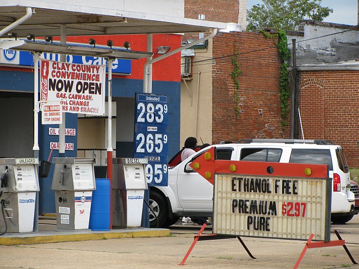
In the afternoon, Eric set his Garmin to finding us a Dairy Queen along our
route for milkshakes. It took us here:
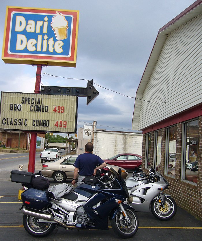
I guess it might have been a Dairy Queen once upon a time. No
matter; we got our milk shakes and they even made a pot of coffee just for me.
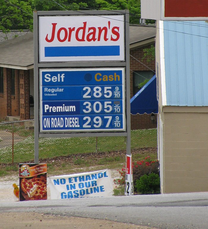
Within a few hundred feet, there were two different gas stations offering
Ethanol-free fuel. Sadly, our tanks were mostly full.
We had been watching a huge line of storms all day using the Accuweather app on
my iPhone. These were the storms which caused the massive flooding in
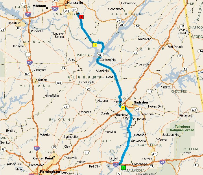
western Tennessee. By the time we got to Lincoln AL at I20 a
bit north of Talladega, it became obvious that we would not be able to make it
to Huntsville by dark and the storms looked like they would come east, so we
decided to call it a day there. We settled into a Comfort Inn, and
had dinner in a Mexican restaurant within walking distance.
Day 13: Saturday 1. May -- Lincoln to Huntsville ~95 miles
As we woke up this morning, the line of storms we were watching had still not
moved much. The edge of the line was just north of Huntsville and
figured Huntsville would get drenched when they finally did move.
Still, we decided to go in that direction anyway and likely spend the rest of
the day there waiting out the weather. We got there by
lunchtime without getting wet. We had lunch with our friend,
then spent the afternoon at her house, setting up a wireless network for her,
then went to dinner on the other side of town at the
Ol Heidelberg German restaurant,
which was decent, but not outstanding. The area around Lake Gunther
was nice, but we neglected to take any pictures that day.
We stayed overnight in a former EconoLodge, now a VIP Inn, on the southwest
outskirts of Huntsville. This was the worst place we stayed the during the
whole trip; a dump. It never did rain while we were in
Huntsville, it just looked like it was going to the entire time.
Day 14: Sunday 2. May -- Huntsville AL to Knoxville
TN, ~300 miles
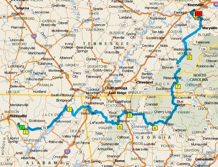
The weather that morning still looked dreary, and the line of storms had still
not moved, remaining to the northwest, so we decided to press on in the
direction of Knoxville. We wanted to have lunch with
another friend who had just moved to Dalton, GA, so off we went.
The first portion of the this day mostly on US 72 was a boring drone; this is a
divided (but not limited access) highway that's pretty straight and flat.
Our Garmins thought we should continue up to I24 despite the number 4 waypoint
you see on the map above. Needless to say, we did not like that idea
very well, so we ended up back-tracking about a mile and taking the route which
Streets and Trips plotted above.
This section was actually a pretty nice ride through the mountains of rural
northeastern Alabama and northwestern Georia. Traffic was minimal, but the
few cars that were on those roads went way too slow in the "fun" sections.
After lunch with our friend in Dalton, we kept going east to get to some some
northbound roads which looked like they might be fun. We had planned this
all along, but it had the added benefit of keeping us away from the line of
storms which was stalled to our northwest. The run up
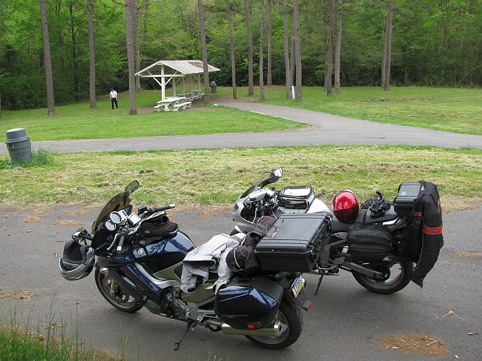
GA Rte 5, and TN Rtes 68 and 360 was excellent. Here we are at a
roadside rest area which I think was on TN Rte 68:
After that we had a boring section of US 411 to a short hop on I140 to our
destination on the southwestern outskirts of Knoxville. It
finally started raining a bit when we were just a few miles from our hotel, but
it wasn't enough to make it worthwhile to put on the rain gear.
It started raining in earnest a few minutes after we got checked into the Sleep
Inn. Our local friends then picked us up in their car and we went out to
dinner, and it rained all night.
We had now been on the road for two full weeks, which was my
original estimate for the whole trip. I suppose it's a good thing I
signed out of work for 3 weeks! :-) But the best was yet
to come, so if you're still not bored, you can continue to the third page of
this story by clicking the following link:
Continue to Page 3


